 Official Site of The State of New Jersey
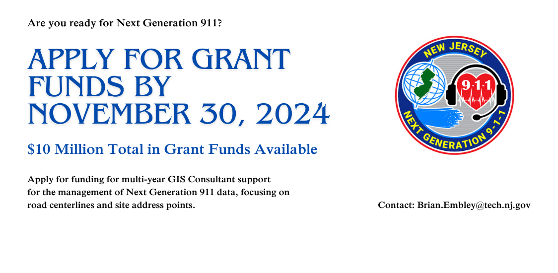
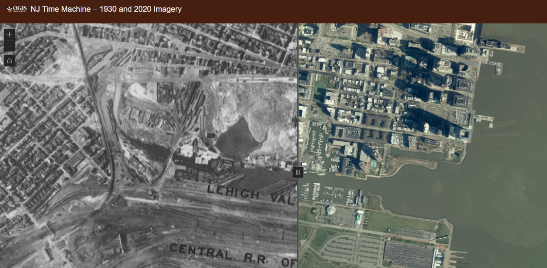
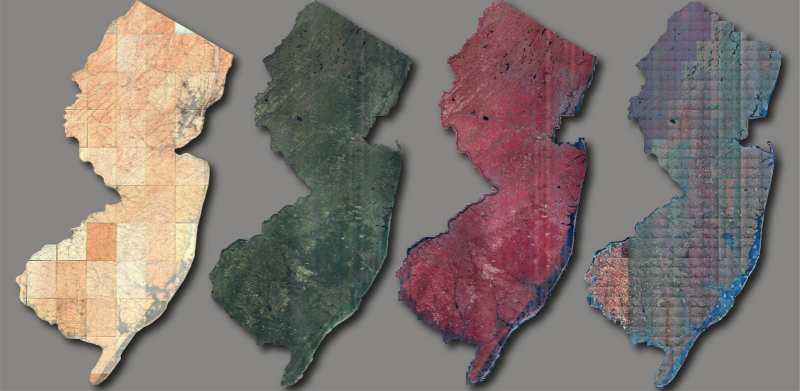
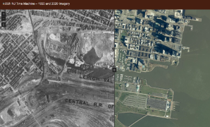
NJ Time Machine – 1930 and 2020 Imagery
See the many changes in the New Jersey landscape over a 90-year span from 1930 to 2020
Learn More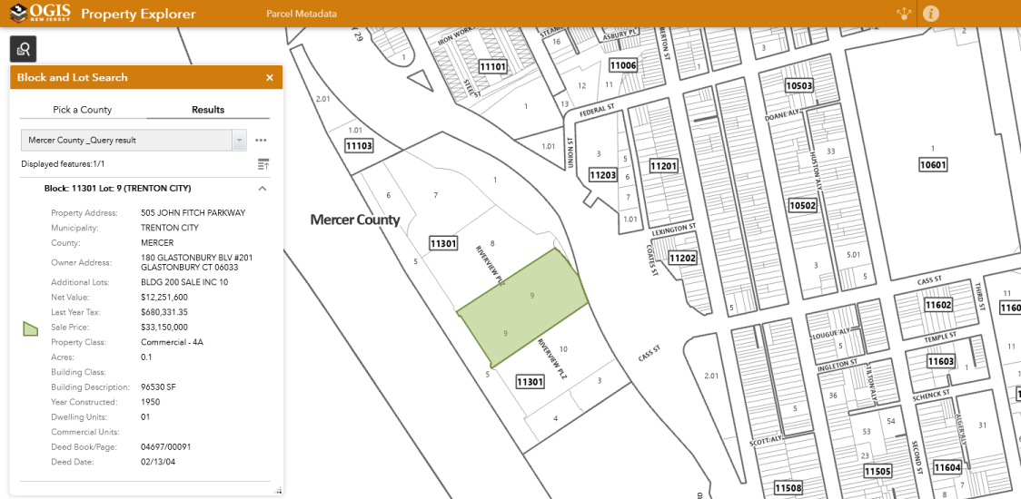
Property Explorer App
Search all parcels in NJ by address, county, municipality, block and lot
Learn More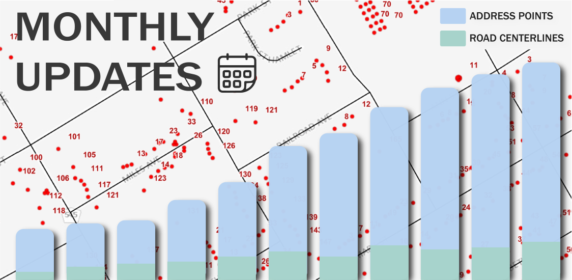
Monthly Updates
Beginning June 2022, the road centerlines, address points, and statewide geocoding service will be updated monthly
Looking for imagery?
Download using the Imagery Warehouse app and AWS Command Line Interface, or stream online
Learn More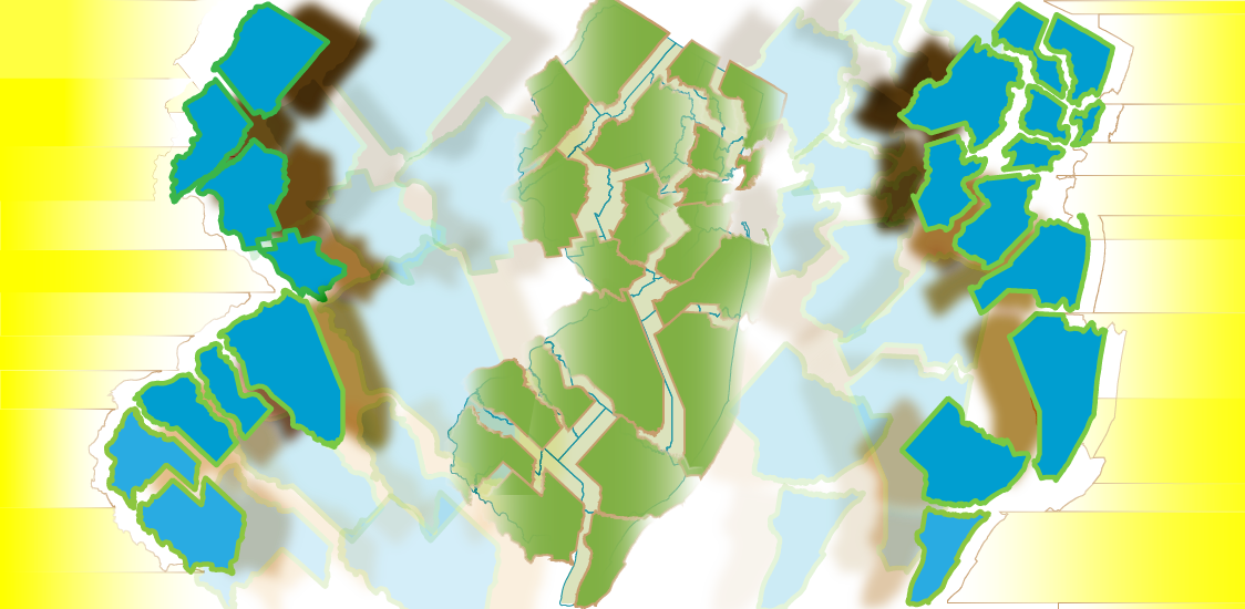
Need jurisdictional boundary data for your web apps?
NJ County, Municipal Boundaries, and Centroids as high performance feature services, leveraging ArcGIS Online's scalable infrastructure. Available in both NJ State Plane (3424) and Web Mercator (3857).
Jurisdictional Boundary Data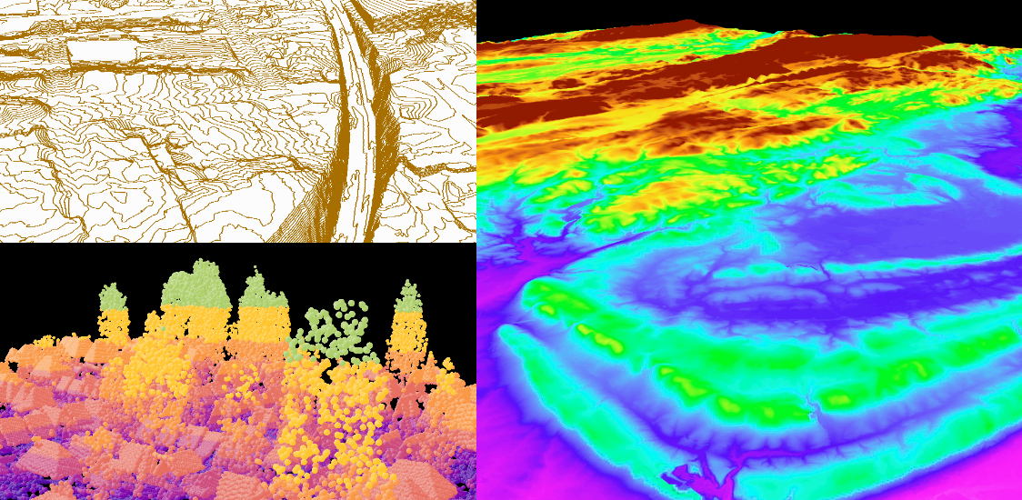
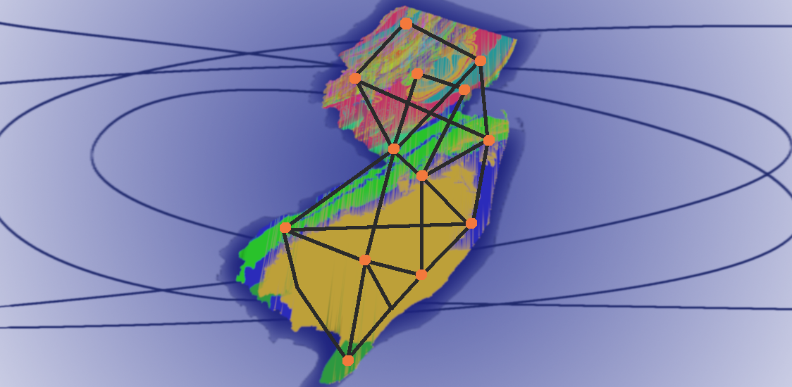
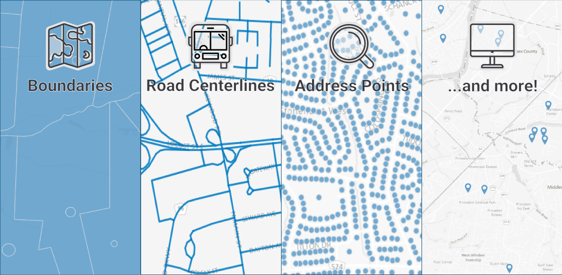
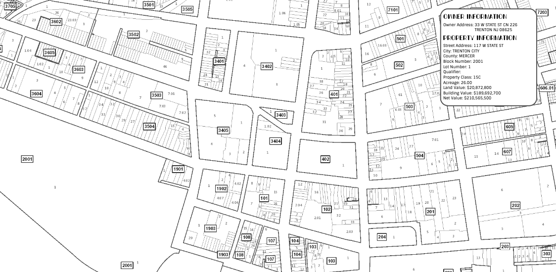
Parcel Data
Learn about NJ parcel boundaries, property ownership info, and access to these datasets
Learn MoreFind GIS Data
NJ Time Machine – 1930 and 2020 Imagery
See the many changes in the New Jersey landscape over a 90-year span from 1930 to 2020
Learn More
Property Explorer App
Search all parcels in NJ by address, county, municipality, block and lot
Learn More
Monthly Updates
Beginning June 2022, the road centerlines, address points, and statewide geocoding service will be updated monthly
Looking for imagery?
Download using the Imagery Warehouse app and AWS Command Line Interface, or stream online
Learn More
Need jurisdictional boundary data for your web apps?
NJ County, Municipal Boundaries, and Centroids as high performance feature services, leveraging ArcGIS Online's scalable infrastructure. Available in both NJ State Plane (3424) and Web Mercator (3857).
Learn More
Parcel Data
Learn about NJ parcel boundaries, property ownership info, and access to these datasets
Learn MoreFind GIS Data
Maintenance scheduled for NJOGIS map services & applications
Due to scheduled maintenance, NJOGIS map services & applications may be unavailable on Monday, October 21, 2024 from noon to 1pm. We apologize for any inconvenience.
October 2024
NJ Next Gen 911 Grant FY 2025
Counties and Municipalities with a population over 65,000 residents may apply for funding for multi-year GIS Consultant support for Next Generation 911 data management of road centerlines and site address points. In your application please include costs to meet Section IV) A) on page 4 of the grant document. Apply for grant funds by November 30, 2024. Email Brian Embley with questions.
October 2024
New Esri Contract With New Jersey Now in Effect
The New Jersey Office of GIS is pleased to announce that there is a new contract with Esri and the State in place. The contract covers Esri's GIS software and services and can be used by any governmental entity in New Jersey. Information on the contract, such as the current price list and the method of operation, may be found on NJSTART. Please note that there is a new master blanket purchase order number of 25-TELE-82239.
July 2024
NJOGIS applications and services to be retired on Monday, June 10
The NJ Office of GIS will be retiring GIS applications and services in favor of hosted (cloud) services capable of high demand and services published by authoritative GIS data stewards. These GIS applications and services will be taken down on or around Monday, June 10, 2024. View the list of retirements at the link below.
June 2024
Updated Parcels data available for New Jersey
Recent data updates include Cumberland, Hudson, Middlesex, Monmouth, and Somerset Counties.
May 2024
NJ Time Machine App Released – 1930 and 2020 Imagery
The Time Machine application juxtaposes existing statewide orthoimagery libraries from 1930 and 2020 to let users see the changes to the New Jersey landscape over the intervening 90 years.
January 2024
Interactive Maps
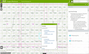
Imagery Warehouse
Interactively download tiles from the most frequently requested imagery collections
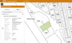
Property Explorer App
Search all parcels in NJ by address, county, municipality, block and lot
NJ Time Machine – 1930 and 2020 Imagery
See the many changes in the New Jersey landscape over a 90-year span from 1930 to 2020
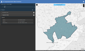
Congressional District Finder
Search for U.S. Senators and Congressional Representatives by address
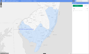
2019 South NJ LiDAR Collection
Download point cloud data (.laz files) and other elevation products
2018 Northwest NJ LiDAR Collection
Download point cloud data (.laz)