 Official Site of The State of New Jersey
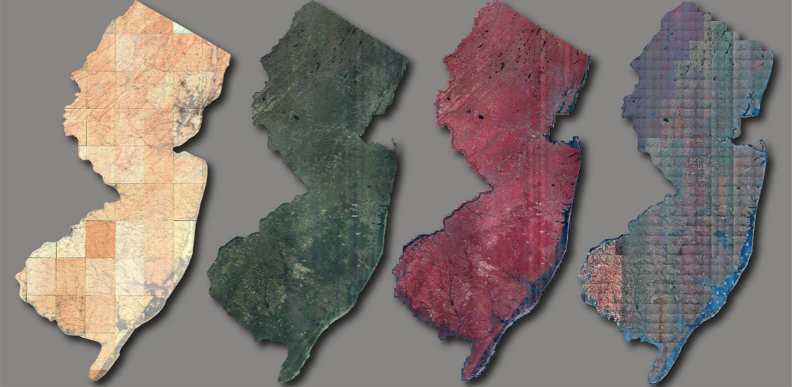
Looking for imagery?
Download using the Imagery Warehouse app and AWS Command Line Interface, or stream online
Learn More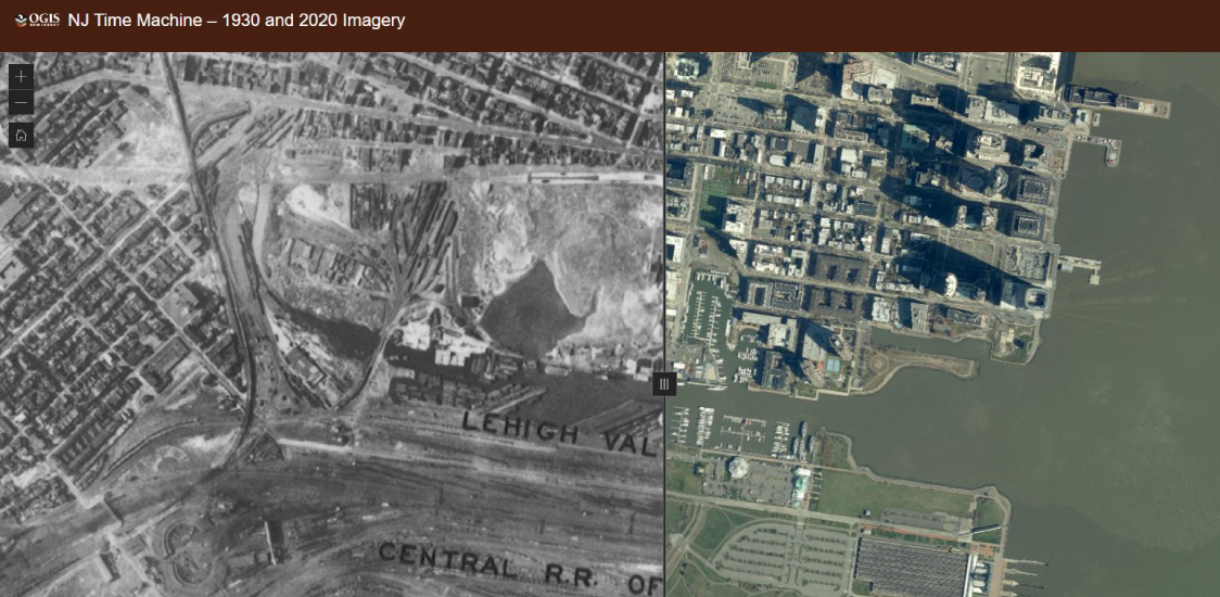
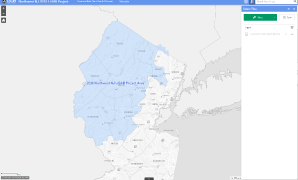
NJ Time Machine – 1930 and 2020 Imagery
See the many changes in the New Jersey landscape over a 90-year span from 1930 to 2020
Learn More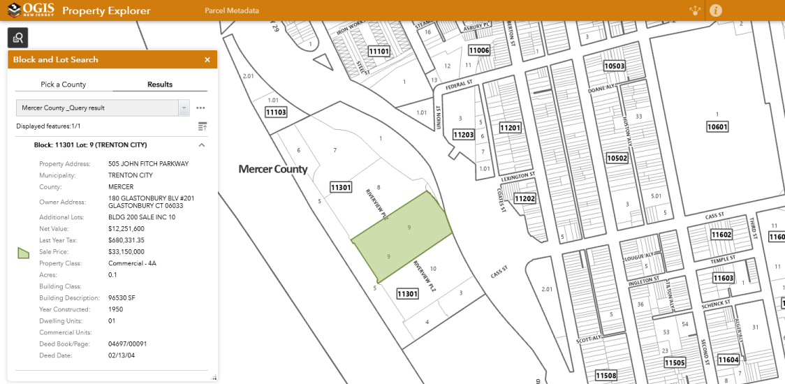
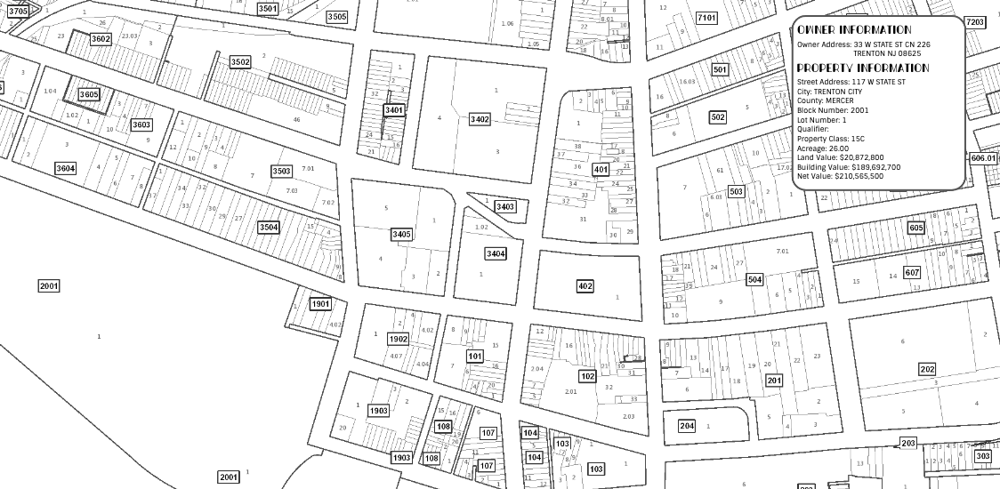
Property Explorer App
Search all parcels in NJ by address, county, municipality, block and lot
Learn More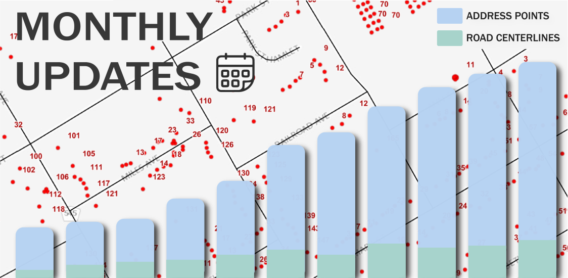
Monthly Updates
Beginning June 2022, the road centerlines, address points, and statewide geocoding service will be updated monthly
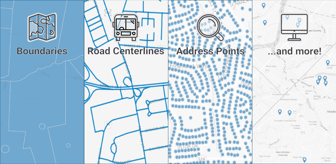
Parcel Data
Learn about NJ parcel boundaries, property ownership info, and access to these datasets
Learn MoreFind GIS Data
Looking for imagery?
Download using the Imagery Warehouse app and AWS Command Line Interface, or stream online
Learn More
NJ Time Machine – 1930 and 2020 Imagery
See the many changes in the New Jersey landscape over a 90-year span from 1930 to 2020
Learn More
Property Explorer App
Search all parcels in NJ by address, county, municipality, block and lot
Learn More
Monthly Updates
Beginning June 2022, the road centerlines, address points, and statewide geocoding service will be updated monthly
Parcel Data
Learn about NJ parcel boundaries, property ownership info, and access to these datasets
Learn MoreFind GIS Data
Maintenance scheduled for NJOGIS map services & applications
Due to scheduled maintenance, NJOGIS map services & applications may be unavailable on Monday, May 19, 2025 from 9am to 2pm. We apologize for any inconvenience.
May 2025
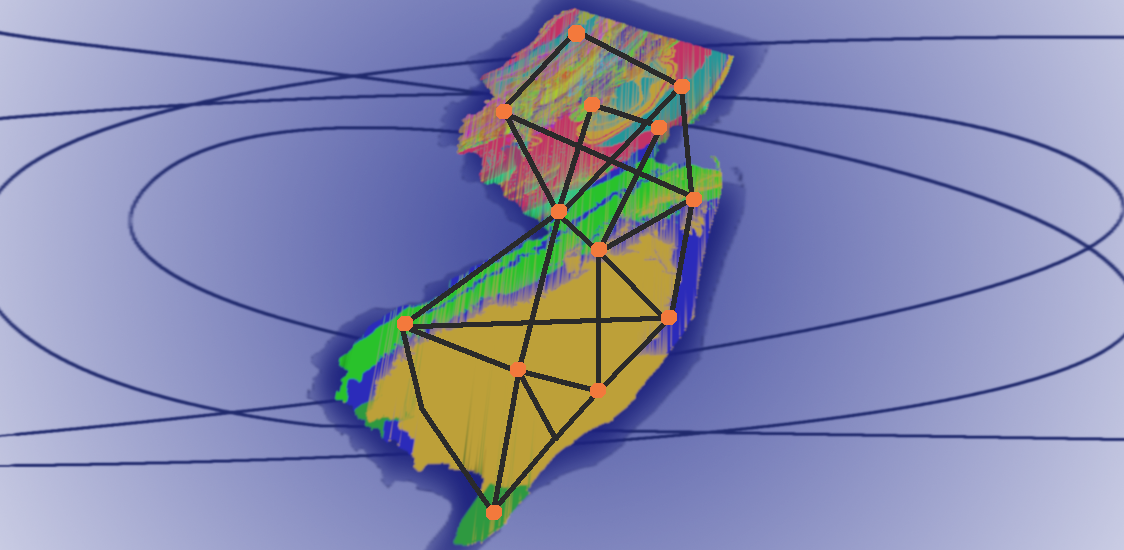
NJ Administrative Boundaries Publication Update
To ensure compatibility with ArcGIS Online Hosted Feature Services, additional geoprocessing steps have been applied to the following administrative boundary datasets including the Municipal, County, State, Legislative Districts and Congressional Districts data layers.
Several municipal boundary refinements have also been made in conjunction with the recent Statewide Parcels update. For more details, consult the process step lineage of the metadata record.
For reference, the ArcGIS Online compatibility issue we encountered is that Hosted Feature Services cannot contain Bezier or elliptical curves. When downloaded from ArcGIS Online, this leads to polygons with negative areas. The only remedy at this time is to replace the curves with densified line segments to approximate the curve. We are retaining the curves in our source data internally.
April 2025
Summer GIS Internship at NJOGIS
The internship position will work under direct supervision to validate the broadband address map, focusing on areas with recent updates. GIS experience is not required. Instruction will be provided in the use of GIS and mapping software tools to review, check and flag erroneous address locations on a digital GIS map. Open to all majors and fields of study. The ability to use a computer and read maps is required as is a willingness to learn.
April 2025
Updated NJOGIS ArcGIS Online hosted parcels layer
The Parcels and MOD-IV Composite of New Jersey in Web Mercator (3857) hosted ArcGIS Online layer has been updated with data from the 2023 tax year, along with recent data updates from Egg Harbor Township in Atlantic County, Bergen County, Camden County, Gloucester County, Mercer County, Lincoln Park Borough in Morris County, and Salem County.
April 2025
Maintenance scheduled for NJOGIS ArcGIS Online parcels layer
Due to scheduled maintenance, the Parcels and MOD-IV Composite of New Jersey in Web Mercator (3857) ArcGIS Online layer may be unavailable on Monday, March 31, 2025 from 8am-4pm. We apologize for any inconvenience.
If there is a need to avoid disruption, please connect to our test version of the parcels layer which can be found here: Parcels Composite NJ WM Hosted Test.
March 2025
Updated parcels and MOD-IV data available for New Jersey
The Statewide Parcel and MOD-IV Composite has been updated with data from the 2023 tax year, along with recent data updates from Egg Harbor Township in Atlantic County, Bergen County, Camden County, Gloucester County, Mercer County, Lincoln Park Borough in Morris County, and Salem County. NOTE: This update is currently only available as a download. The hosted Statewide Parcel and MOD-IV Composite will be updated at a later time. A follow-up announcement will be made when the hosted data is updated.
February 2025
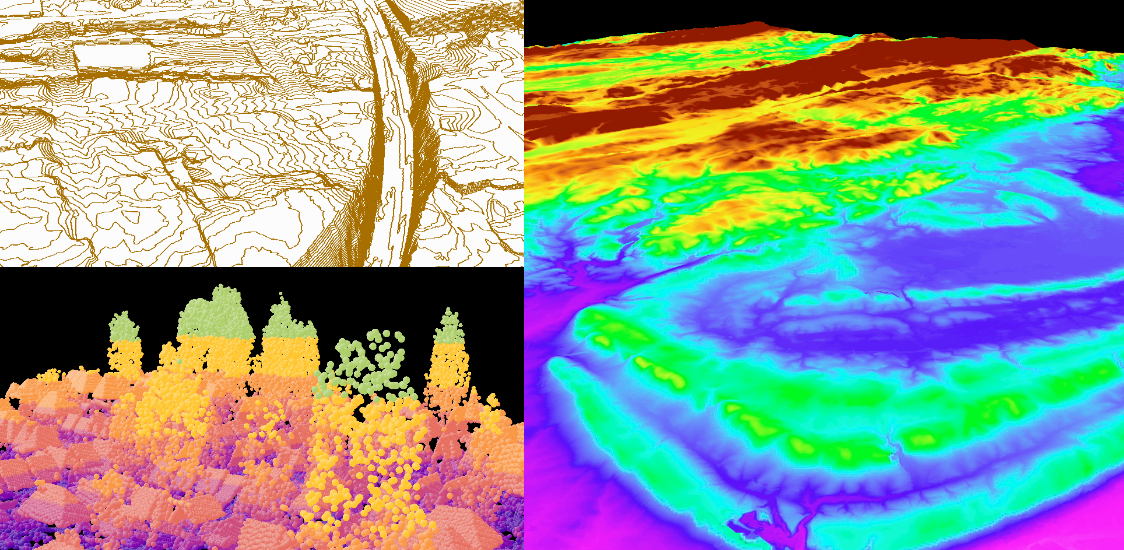
LiDAR downloader apps for 2018 & 2019 data updated
The 2018 Northwest NJ & 2019 South NJ LiDAR downloader applications are now live in ArcGIS Experience Builder. Check them out!
Northwest NJ 2018 LiDAR App
South NJ 2019 LiDAR App
Please note that these are new URLs. The old ArcGIS Web AppBuilder applications will be retired on January 31, 2025.
December 2024
Maintenance scheduled for NJOGIS map services & applications
Due to scheduled maintenance, NJOGIS map services & applications may be unavailable on Monday, May 19, 2025 from 9am to 2pm. We apologize for any inconvenience.
May 2025
NJ Administrative Boundaries Publication Update
To ensure compatibility with ArcGIS Online Hosted Feature Services, additional geoprocessing steps have been applied to the following administrative boundary datasets including the Municipal, County, State, Legislative Districts and Congressional Districts data layers.
Several municipal boundary refinements have also been made in conjunction with the recent Statewide Parcels update. For more details, consult the process step lineage of the metadata record.
For reference, the ArcGIS Online compatibility issue we encountered is that Hosted Feature Services cannot contain Bezier or elliptical curves. When downloaded from ArcGIS Online, this leads to polygons with negative areas. The only remedy at this time is to replace the curves with densified line segments to approximate the curve. We are retaining the curves in our source data internally.
April 2025
Summer GIS Internship at NJOGIS
The internship position will work under direct supervision to validate the broadband address map, focusing on areas with recent updates. GIS experience is not required. Instruction will be provided in the use of GIS and mapping software tools to review, check and flag erroneous address locations on a digital GIS map. Open to all majors and fields of study. The ability to use a computer and read maps is required as is a willingness to learn.
April 2025
Updated NJOGIS ArcGIS Online hosted parcels layer
The Parcels and MOD-IV Composite of New Jersey in Web Mercator (3857) hosted ArcGIS Online layer has been updated with data from the 2023 tax year, along with recent data updates from Egg Harbor Township in Atlantic County, Bergen County, Camden County, Gloucester County, Mercer County, Lincoln Park Borough in Morris County, and Salem County.
April 2025
Maintenance scheduled for NJOGIS ArcGIS Online parcels layer
Due to scheduled maintenance, the Parcels and MOD-IV Composite of New Jersey in Web Mercator (3857) ArcGIS Online layer may be unavailable on Monday, March 31, 2025 from 8am-4pm. We apologize for any inconvenience.
If there is a need to avoid disruption, please connect to our test version of the parcels layer which can be found here: Parcels Composite NJ WM Hosted Test.
March 2025
Updated parcels and MOD-IV data available for New Jersey
The Statewide Parcel and MOD-IV Composite has been updated with data from the 2023 tax year, along with recent data updates from Egg Harbor Township in Atlantic County, Bergen County, Camden County, Gloucester County, Mercer County, Lincoln Park Borough in Morris County, and Salem County. NOTE: This update is currently only available as a download. The hosted Statewide Parcel and MOD-IV Composite will be updated at a later time. A follow-up announcement will be made when the hosted data is updated.
February 2025
LiDAR downloader apps for 2018 & 2019 data updated
The 2018 Northwest NJ & 2019 South NJ LiDAR downloader applications are now live in ArcGIS Experience Builder. Check them out!
Northwest NJ 2018 LiDAR App
South NJ 2019 LiDAR App
Please note that these are new URLs. The old ArcGIS Web AppBuilder applications will be retired on January 31, 2025.
December 2024
Interactive Maps
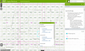
Imagery Warehouse
Interactively download tiles from the most frequently requested imagery collections
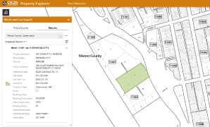
Property Explorer App
Search all parcels in NJ by address, county, municipality, block and lot
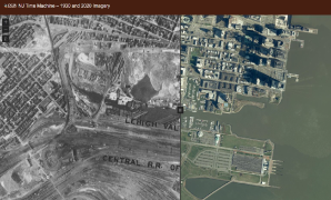
NJ Time Machine – 1930 and 2020 Imagery
See the many changes in the New Jersey landscape over a 90-year span from 1930 to 2020
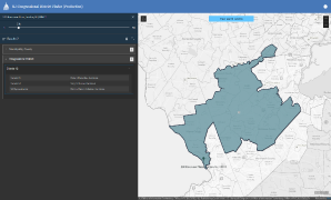
Congressional District Finder
Search for U.S. Senators and Congressional Representatives by address
2018 Northwest NJ LiDAR Collection
Download point cloud data (.laz)
2019 South NJ LiDAR Collection
Download point cloud data (.laz files) and other elevation products